The Ak Suu Traverse: The Essential Guide
I’ll put it plainly: the Ak Suu Traverse is not only the best hike in Kyrgyzstan’s Tian Shan mountains, but in Kyrgyzstan’s mountains, full stop.
I first read about the Ak Suu Traverse in National Geographic’s book 100 Hikes of a Lifetime. I was hooked and when planning my time in Kyrgyzstan, put it at the top of my must-do list. (Side note: if you’re into hiking, it’s a great book by the way).
Travelling over 100 km throughout some of the best alpine scenery in Kyrgyzstan, the Ak Suu Traverse is beautiful, hardcore and a once in a lifetime adventure. It’s not for the faint of heart though, and requires a hell of a lot of planning.
Sound like your cup of tea? Well then, read on for our Essential Guide to the Ak Suu Traverse Trek.
Kyrgyzstan Travel Resources
- Start here: 14 Awesome Things to Do in Kyrgyzstan
- Getting there: search for flights to Kyrgyzstan
- Guidebook: pick up a Bradt Kyrgyzstan guidebook
- Where to stay: search for guesthouses or yurts
- How to get around: rent a car to get around Kyrgyzstan
- Travel insurance: get travel insurance for your trip
- Money: get a Wise travel card to save big time in Kyrgyzstan
- Gear: pick up a Steripen for clean water 24/7
- Tours: check out the best Kyrgyzstan tours
Ak Suu Traverse Trek: Overview
- Location: Ak Suu region (near Karakol), Issyk-Kul Oblast (Eastern Kyrgyzstan)
- Length: 110 km
- Elevation gain: +7155m
- Elevation loss: -7465
- Time: 7 – 10 days
- Season: June to September
- Gateway city: Karakol
- Type: One-way
- Booking Required: No
- Sleeping: Camping
- Start: Jyrgalan
- Finish: Jeti Oguz
- Difficulty: Extreme
- What to expect: The absolute best of Kyrgyzstan’s mountains – snowcapped mountains, glaciers, verdant valleys, shimmering lakes and more mountain passes than you thought possible
What is the Ak Suu Traverse
The Aku Suu Traverse is, quite simply, the ultimate hike in Kyrgyzstan’s Tian Shan Mountains.
Traversing a large section of Kyrgyzstan’s mountains in the northeast of the country, the Ak Suu Traverse is quickly gaining legendary status amongst serious hikers the world over.
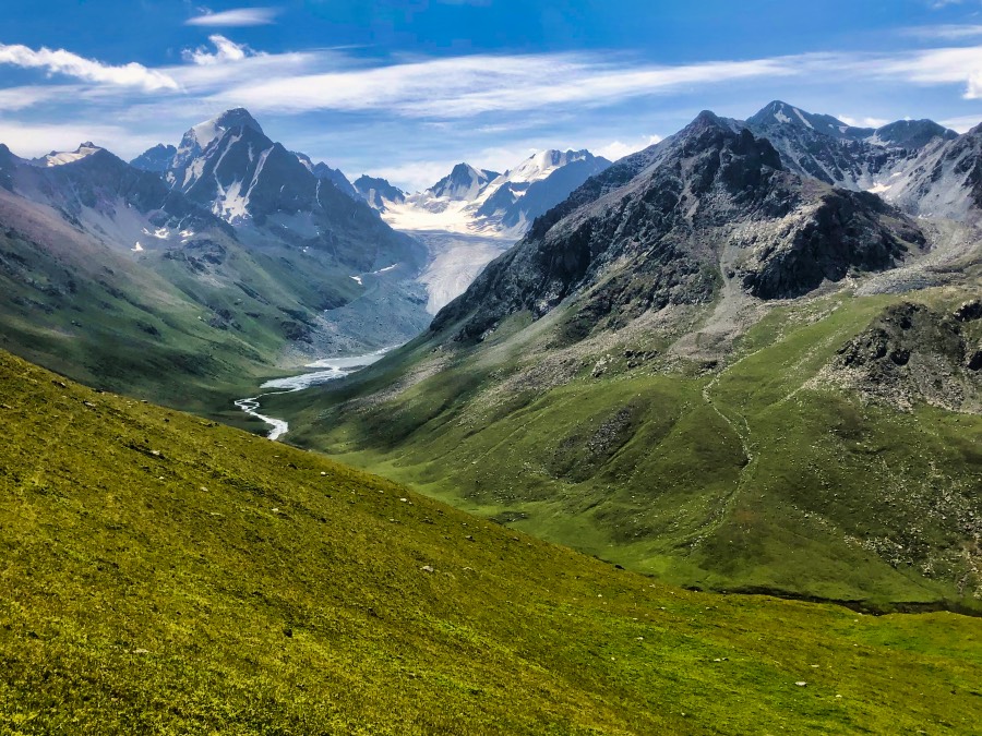
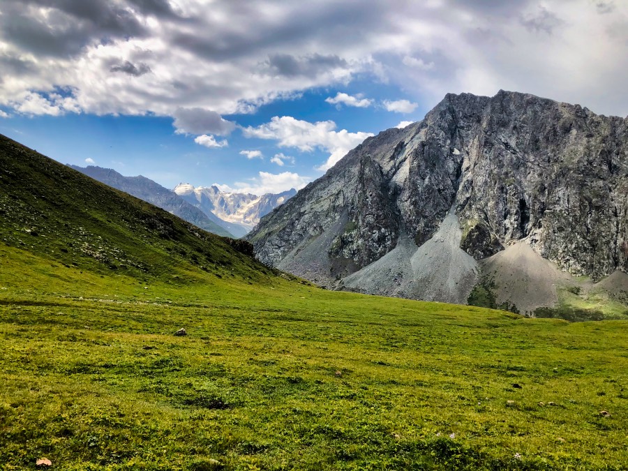
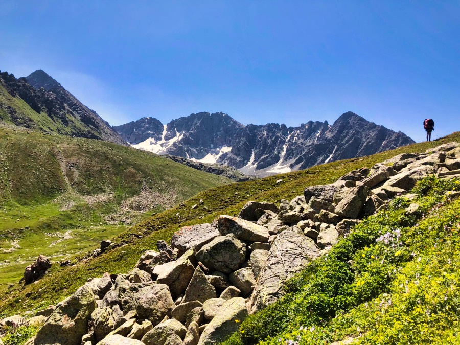
Why the rising popularity? Well, for starters, the landscape is varied and not to mention, exceptionally beautiful: there are green valleys, shimmering lakes, glaciers and rocky outcrops. It features everything you could ask for in a hike in Kyrgyzstan’s mountains and much more.
It crosses some of the region’s best-known highlights, such as Altyn Arashan and Ala Kul Lake. But even better, it crosses some of the region’s best-kept secrets, such as the Boz Uchuk Lakes and Ak Suu Alamu Valley. It truly showcases some of Krygzstan’s best mountain scenery.
It’s also off-the-beaten-track, meaning you’re guaranteed to have most of it all to yourself and for most of it, feel like you’re on a National Geographic expedition.
And finally, it’s a long trail and very physically demanding, making it all the more appealing for us hiking masochists out there who like to push it as far as we can. You know who you are.
Want another epic hike? Check out the Rwenzori Mountains in Uganda
Ak Suu Traverse Location
The Ak Suu Traverse is located, quite obviously, in Kyrgyzstan’s Ak Suu region. It traverses a broad swath of Krygzstan’s Tian Shan Mountains, from the teeny tiny village of Jyrgalan all the way to the Soviet-era health resort of Jeti Oguz.
The nearest city, and where most trekkers base themselves to get organised, is Karakol, the administrative capital of Issyk-Kul Oblast and Kyrgyzstan’s de facto adventure capital.
Read: The Ultimate Guide to Kel Suu Lake
Best Time to Hike the Aku Suu Traverse
The season for hiking the Ak Suu Traverse (or really any of Kyrgyzstan’s mountains for that matter) is from June to September. The best time to do the Ak Suu Traverse is in July and August. During this time, the weather will be at its warmest with the best chances for clear days.
Before June, the passes will still be snowbound and it’s unlikely you’ll be able to cross them. After September, the weather will be too wild and cold to safely hike in this region of Kyrgyzstan’s mountains.
The weather in Kyrgyzstan’s mountains is notoriously unpredictable: it can be sunny in the morning and then turn windy and stormy in the space of a few hours. Even in summer, it can be very cold (and freezing at night), so be sure to pack warm clothes.
Don’t know what to pack? Don’t sweat, we’ve got you covered. See our packing list below.
Want a warm-up hike before conquering the Ak Suu Traverse? Try Kol Tor near Bishkek
How difficult is the Ak Suu Traverse Trek?
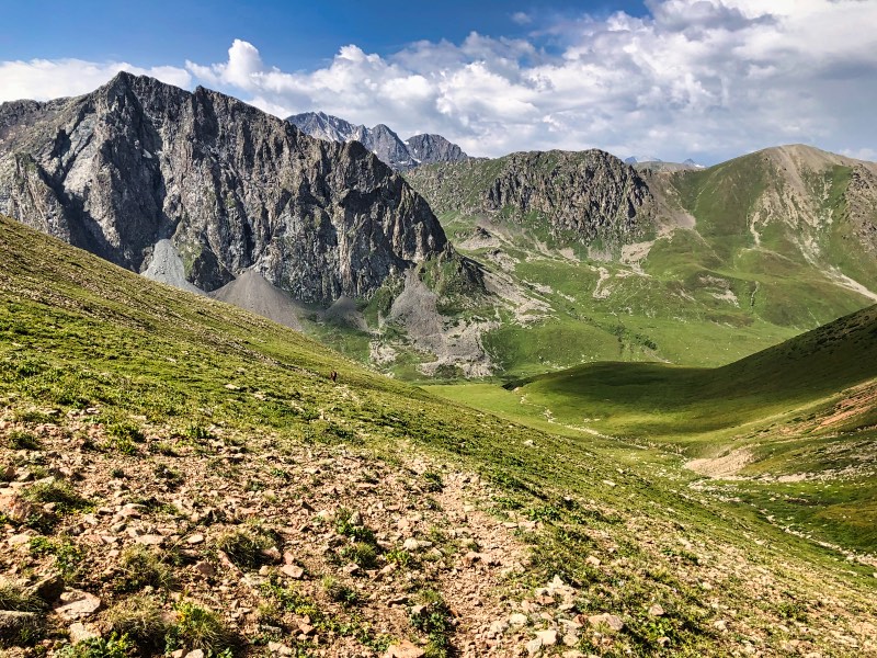
There’s no way around it: the Ak Suu Traverse trek is extremely difficult. Although there are no technical challenges, it’s a physically demanding route with little to no trail. What’s more, it covers some of the most remote terrain in the country, so hikers are largely alone for the vast majority of the Ak Suu Traverse trek.
The Ak Suu Traverse crosses multiple high mountain passes – we’re talking at least a pass a day, and for fun, sometimes you get to cross two. It’s near-constant ascent and descent, without the benefit of a clear trail to follow. You’ll be surprised how much energy you spend navigating when there’s no trail in sight.
Along with the Drakensberg Mountains in South Africa, it’s the most challenging hiking I’ve ever done.
Read 14 Awesome Things to Do in Kyrgyzstan for more epic adventures
Do you need a guide to do the Ak Suu Traverse?
Whether you need a guide to do the Ak Suu Traverse depends on your level of experience and your confidence in trekking in the very remote, high-altitude Kyrgyzstan mountains.
If you’re a beginner, I’m going to be honest: this probably isn’t the hike for you. I’d recommend trying your hand at a trek to Song-Kul, Kol-Tor, or for something a bit challenging, even Ala Kul Lake.
If you’re an intermediate hiker, it’s best to go with a guide. Having a guide and taking the navigational work out of the equation will make your experience immeasurably better (and not to mention safer). It will still be a very physically demanding and challenging experience, without the stress of finding a route every day.
Related – Ala Archa National Park: The Ultimate 2024 Guide
If you would like to book a guide, it’s very easy to do so in Karakol. You can speak to Destination Karakol, or even better, one of the specialist hiking companies in town (EcoTrek Trekking & Travel is the company I know best). Guides aren’t that expensive and can be arranged easily and with little notice.
I’d only recommend doing the Ak Suu Traverse independently for very experienced hikers. Navigating in this remote part of the Kyrgyzstan mountains is no joke and adds significantly more challenges to the entire experience.
Cost of the Ak Suu Traverse
There are no entrance fees or specific costs for the Ak Suu Traverse itself.
Your only set costs for the trek are your transportation to Jyrgalan and back from Jeti Oguz and your food for the duration of the hike. Extras that you may need to budget for include spending money for Altyn Arashan (bring cash) and whatever support options you may choose (i.e., porters, food drops, etc.).
Where to next? Read about Tash Rabat Caravanserai
Transportation
It’s very easy to organise your transport for the Ak Suu Traverse, with options for both public transport and private taxi hire.
How to get to the start of the Ak Suu Traverse
To start the Ak Suu Traverse, you must first get to Jyrgalan.
From Karakol, you can take a marshrutka (minibus). Marshrutka #33 leaves from the Ak-Tilek Market (“the Big Bazaar”) bus station, which is located at the intersection of Bektenova and Zhamansariev Streets.
In summer, the marshrutkas depart at 8:30am, 1:30pm and 5:30pm. The ride takes around 2 hours and costs around 90 KGS.
I recommend getting to the bus station early to get a seat. The Jyrgalan marshrutkas fill up quickly!
Important: be sure to confirm that the marshrutka goes all the way to Jyrgalan, as some only go as far as Ak Suu.
Of course, you can always hire a taxi to take you to Jyrgalan. These cost around 2000 KGS for up to 4 people. Any guesthouse can arrange this.
How to leave the end of the Ak Suu Traverse
The Ak Suu Traverse finishes at the Jeti Oguz Resort. Note that this is 15 km away from the town of Jeti Oguz.
There are infrequent marshrutkas from Jeti Oguz Resort to Karakol (100 KGS). If you’re not lucky in getting one of these, you can either hitchhike to Jeti Oguz town or arrange a lift from the resort to Jeti Oguz town (around 60 KGS).
Once in Jeti Oguz town, there are very frequent marshrutkas back to Karakol.
And, as always, you can arrange for a taxi to pick you up at the Jeti Oguz Resort. Any guesthouse can arrange this, as can Destination Karakol or the Karakol CBT office. This should cost around 1000 KGS.
(Although with the inflation spike of the past year, I wouldn’t be surprised if this has changed. If anyone has updated info on prices, hit us up!).
Ak Suu Traverse Itineraries
There are many, many different ways to build an itinerary of the Ak Suu Traverse. Although the trail is the same, there are multiple ways that you can split your sections up.
How you choose to build your itinerary will depend on the time you have, your hiking experience and what you’re after.
The Ak Suu Traverse trek can be done in 7 days, however, I wouldn’t recommend this. This would mean massive days back to back, with no allocation for a rest day (trust me, you’ll want one).
Doing the Ak Suu Traverse in 7 days is an arduous slog that leaves little room to appreciate the sheer beauty of Kyrgyzstan’s mountains. Of course, if you’re going on a fully-supported hike, then 7 could be done.
If walking independently, my recommendation is 9 days, including a rest day at Altyn Arashan. This way, you’ll have a mixture of both big and shorter days, plus you get the benefit of a day to rest up with some lovely hot springs.
Ak Suu Traverse 9-Day Itinerary
This itinerary is for 8 days of walking, with a rest day in the middle. This Ak Suu Traverse itinerary allows plenty of time to enjoy the area and soak in what is arguably the best hike in Kyrgyzstan.
Day 1: Jyrgalan to Terim Tor Bulak
- Distance: 13.5 km
- Elevation gain: +947m
- Elevation loss: -100m
- Difficulty: Moderate
- Walking time: 4 – 5 hours
The trail starts by walking up the Jyrgalan Valley and then the Terim-Tor Bulak Valley. Once in the Terim-Tor Bulak Valley, there’s an old jeep track at first, which quickly turns into a dirt track. The track then disappears completely!
The terrain can get very marshy/boggy, so Goretex boots are a lifesaver.
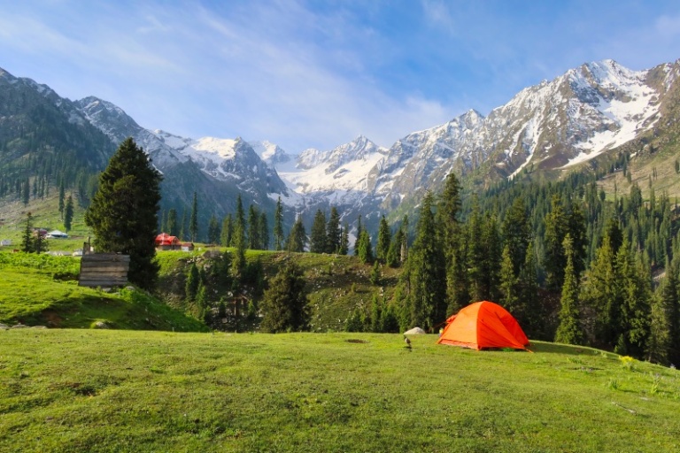
There’s an excellent beach area for camping right at the foot of the pass.
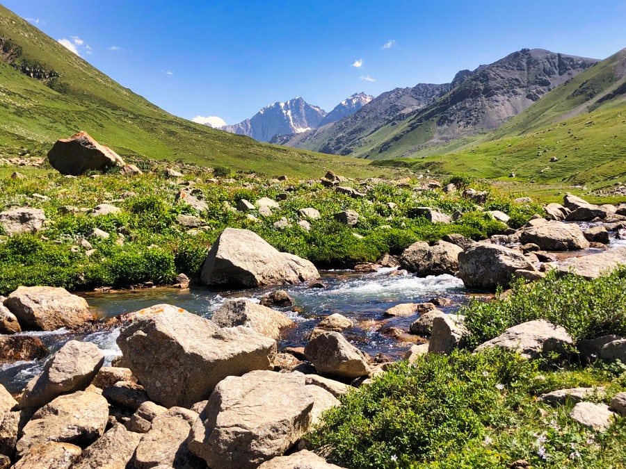
Day 2: Terim Tor Bulak to Boz Uchuk Lakes
- Distance: 14.5 km
- Elevation gain: +1317m
- Elevation loss: -1128m
- Difficulty: Hard
- Walking time: 7 – 8 hours
Prepare yourself, this is one of the hardest days on the Ak Suu Traverse trek. There’s not just one, but TWO big mountain passes to conquer.
The Terim Tor Bulak Pass (3467m) begins immediately after breakfast. It’s 480m of elevation gain spread over 1.4 km – ouch! It should take anywhere between 1 – 1.5 hours to get to the top.
From the top of the pass, it’s a long downhill, finally reaching the Turgon Ak Suu Valley.
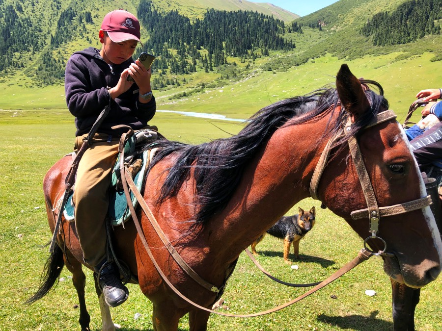
When I hiked the Ak Suu Traverse in July 2022, the bridge to cross the Turgon Ak-Suu River had been washed away. If this is still the case, don’t worry, there are some very enterprising kids around who will help you across on their horses – for a steep fee. You can try to negotiate, but they’re very well aware of who holds the power in this situation and are unlikely to budget. (Alternatively, it’s a very long detour).
Once on the other side, you start the ascent of the Boz Uchuk Ashuu Pass (3363m). It starts steep but then levels out, making it the more manageable of the day’s passes. Overall, you’ll gain about 700 vertical meters over 4 km.
The top of the pass is beautiful, but the horse flies were out for blood (seriously), so I had little time to enjoy the view. It was too painful.
It’s another long descent down the Boz Uchuk Ashuu Pass. At this point, pay attention to your map and be mindful to not overshoot the turn for the lakes.
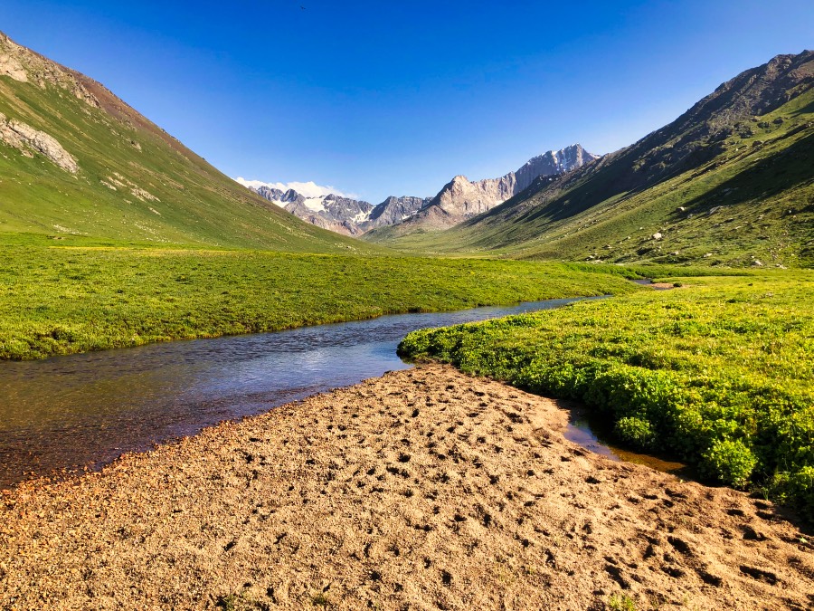
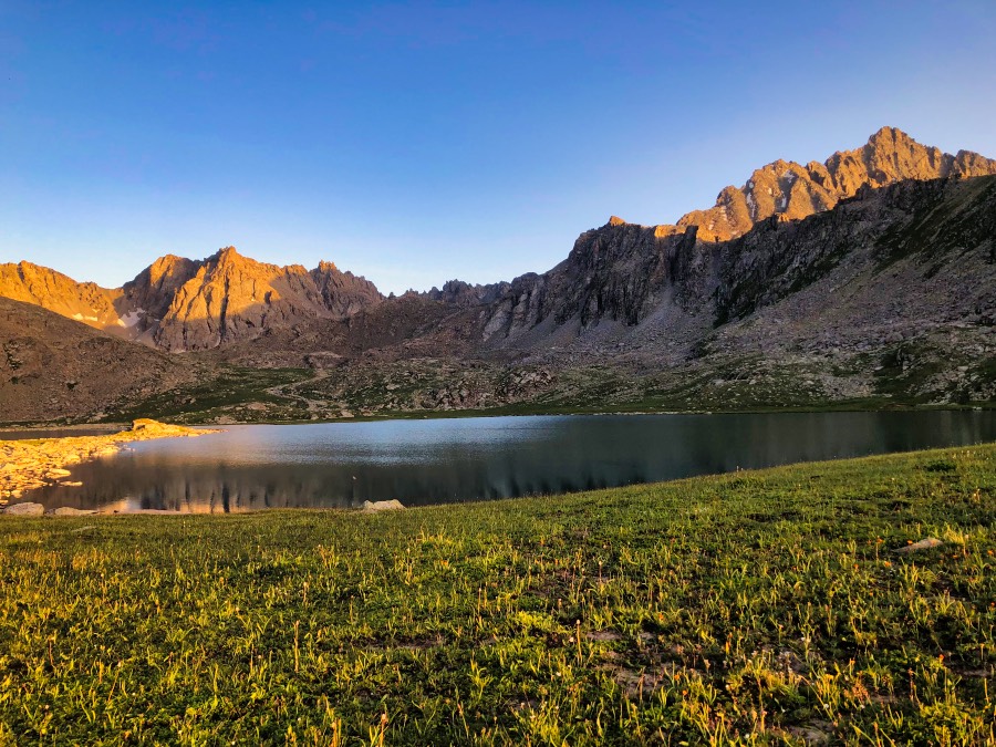
The Boz Uchuk lakes are super beautiful and a great place to camp.
Day 3: Boz Uchuk Lakes to Alianyash Lakes
- Distance: 9 km
- Elevation gain: +650m
- Elevation loss: -250m
- Difficulty: Moderate
- Walking time: 3 – 4 hours
The day begins with a climb up an unnamed pass (3500m). As far as passes go, it’s not too bad, with mostly switchbacks to the top.
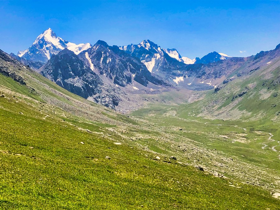
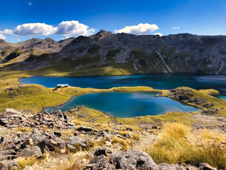
The views from the top of the pass are fantastic – you can see Tashtambek-Tor-Bashi (4463m) and the larger Alianyash Lake.
From the pass, descend to the Alianyash Lakes. This is a great spot to spend the afternoon and evening.
It’s a short day, but after the previous day, it’s a welcome change of pace. You can have a wash, rinse your clothes (but not directly in the lake – a dry bag is a great washing tool), relax and chill out.
There are also several small side valleys around here, which are great for exploring on day hikes if you get there early enough.
There are two lakes, both with great spots for camping. The larger is popular with horses, so choose your camping spot wisely.
I camped up on a bluff overlooking the larger lake (when I was there, there was a dead horse in the smaller lake, so I avoided it).
Day 4: Alianyash Lakes to Ak Su Alamu
- Distance: 8 km
- Elevation gain: +250 m
- Elevation loss: -1250m
- Difficulty: Moderate
- Walking time: 3 – 4 hours
From the lake, start the immediate ascent up the Alianyash Pass (3617m). It’s a pretty easy one, with only 200m of elevation gain from the lake, and a relatively gradual ascent at that.
Once you reach the top, the views from the other side are incredible. This was some of my favourite scenery on the entire Ak Suu Traverse.
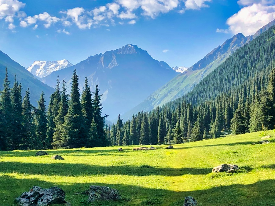
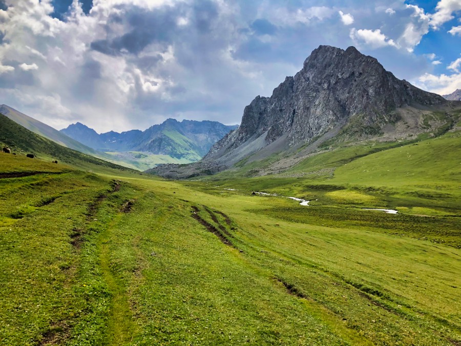
The trail starts by descending steeply and then levels out onto a grassy slope. You’ll eventually reach the Ak Suu Alamu Valley, which is really beautiful.
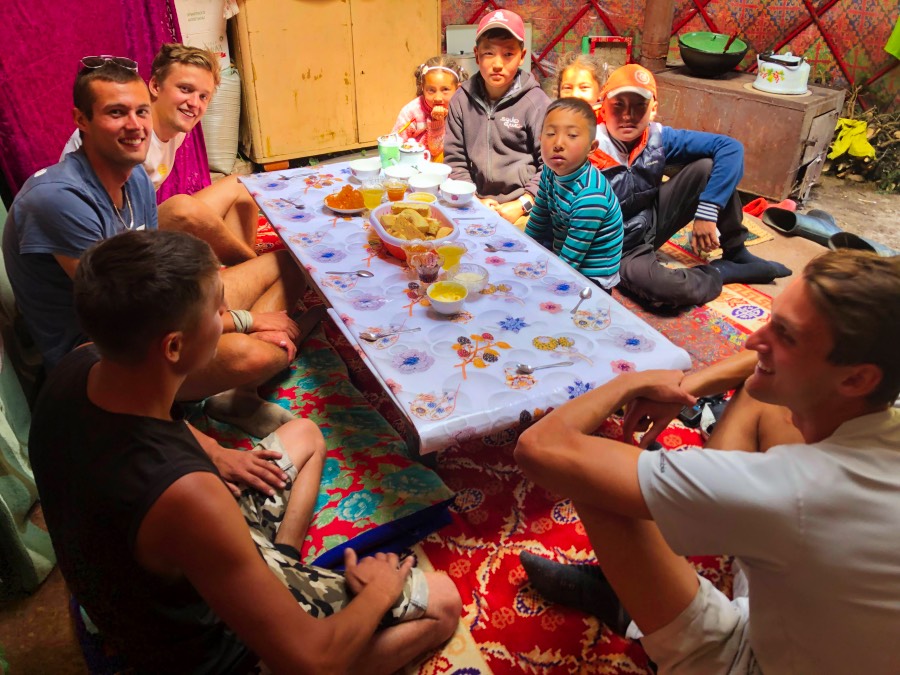
There are a number of shepherds set up in the valley, all of whom were very friendly.
Day 5: Ak Suu Alamu to Altyn Arashan
- Distance: 12 km
- Elevation gain: +950 m
- Elevation loss: -1190m
- Difficulty: Difficult
- Walking time: 5 – 6 hours
Guess what’s up first thing for the day? Another brutal pass (unnamed, 3609m)! You’ll ascend 900m over a paltry 3 km. Oh yeah, and there’s also a false summit. Watch out for that and don’t get your hopes up early.
But, the views from the top of the pass are magnificent.
The first bit of the descent is steep, but there’s a clear path to follow. It then becomes more gradual and turns into a nice decline. Overall, you lose 1100m in under 8 km.
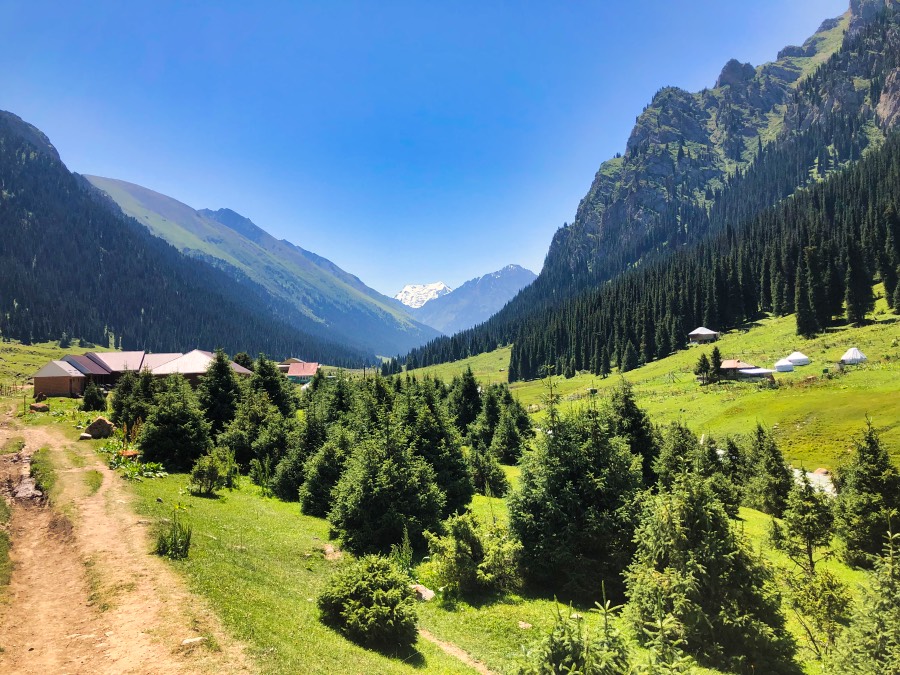
When you reach Altyn Arashan, the valley is a blessing. There’s food available, little shops where you can stock up on items (even fuel for hiking stoves) and even freakin hot springs!
Day 6: Rest day at Altyn Arashan
This will be the best decision you make in a while. Enjoy the hot springs. You have a big day ahead of you tomorrow, so take a break.
Day 7: Altyn Arashan to Ala Kul Lake
- Distance: 12 km
- Elevation gain: +1425 m
- Elevation loss: – 425m
- Difficulty: Difficult
- Walking time: 5 – 6 hours
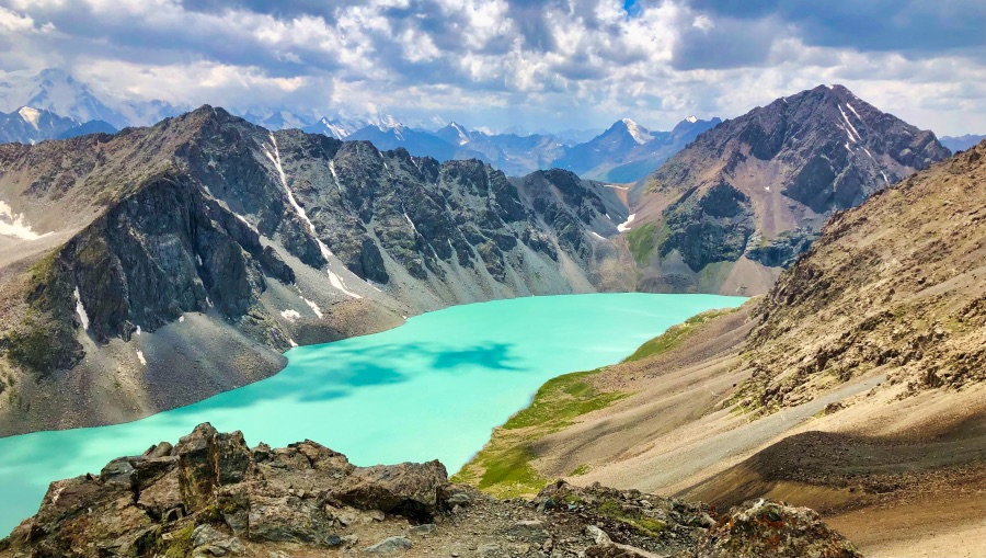
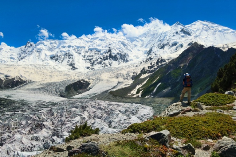
This is a mighty big day, with one of the region’s star attractions, Ala Kul Lake. Over the course of the day, you’ll climb more than 1400m over 10 km of distance.
It’s a slow and steady uphill until you get to the foot of the Ala Kul Pass (3900m). Looking at it, the Ala Kul Pass is terrifying. It’s an almost vertical slope of scree that is very slippery. It is, however, better than it looks.
It should take 30 minutes to get up. It was 30 minutes for everyone I met with a daypack, and 30 minutes for myself, carrying an 18kg pack.
Once you reach the top, the views are magnificent. You see Ala Kul Lake all at once, spread out in her glory.
Compared to the hellish approach, the descent is manageable. You can camp directly at the lake, or on a rocky crop higher up.
Day 8: Ala Kul Lake to Telety Valley
- Distance: 17 km
- Elevation gain: +750 m
- Elevation loss: – 1250m
- Difficulty: Difficult
- Walking time: 7 – 8 hours
From the lake, descend to the Karakol Valley via the Sirota Hut path (the popular trail amongst visitors to Ala Kul Lake). It’s a long, steep descent (about 1100m over 8 km), but much preferable to the dreaded Panorama Pass route.
The first couple of hours of the descent, until you reach Sirota Hut, are pretty rough going. Think rocks, a steep slippery trail and lots of exposed tree branches to avoid tripping on.
Once you reach the Karakol Valley, follow the Karakol River upstream until a side trail at the foot of a large clearing. Follow this into the trees and begin yet another climb! You’ll eventually level out into a wide and beautiful meadow surrounded by very rugged mountains.
Get as far as you can up the valley, to help with the next day’s work.
If you want your final day (day 9) to be a bit shorter, and if you’re not completely spent, you can push on to near Eco Trek’s Camp, just over the Telety Pass.
Day 9: Telety Valley to Jeti Oguz Resort
- Distance: 25 km
- Elevation gain: +690 m
- Elevation loss: – 1850m
- Difficulty: Moderate
- Walking time: 9 – 10 hours
The final pass of the hike is the relatively straightforward Telety Pass (3801m). From here, you begin a long descent, continuing first along the Telety Creek and then the Jeti-Oguz River.
For the last 10 km on the Ak Suu Traverse trek you follow a jeep track down the valley. At this point, you may very well want to flag down a car to shuttle you to the end (saving time and road walking).
You can also arrange for a car to pick you up at this point.
Alternatives
Note that that are infinite variations to this itinerary. I’ve given some examples here, but if you would like to explore further options, speak to any of the trekking agencies in town (not Destination Karakol – they’re not experienced enough in these remote parts).
- Overnight at Sirota Hut rather than Ala Kul Lake. Choosing this option allows you to push further on day 8, which in turn makes day 9 more manageable.
- Take the Panorama Pass down from Ala Kul Lake. Do note that this descent is gnarly as hell and most guides/trekking companies in town don’t recommend this option.
- Leaving Jyrgalan, skip the Terim Tor Pass and instead take the Bulak Ashuu Pass (a little further up the valley). It adds some extra distance but has some very beautiful, and very unknown, lakes.
Important: if for any reason you need to bail out early, simply hike down whichever valley you are in. Eventually, you’ll meet the road which runs parallel to the trek and from there, you can flag down a marshrutka to Karakol. I met a group of young men who had to bail out and this is precisely what they did.
What to Expect on the Ak Suu Traverse Trek
Safety
For a week-long jaunt into some of the most remote of Kyrgyzstan’s mountains, the Ak Suu Traverse is a safe hike, with no serious issues distinct from any other Kyrgyzstan hiking trails.
Isolation is the biggest issue. On the Ak Suu Traverse, you are covering some of the most remote terrain in the country, and if shit goes wrong (like it did for me!), you want to be prepared. It is essential to carry an emergency beacon, tell people of your plans and have a Plan B.
After isolation, altitude is the biggest issue. Much of the trail is over 3000m, including the Ala Kul Pass at just under 3900m. Monitor yourself for altitude sickness symptoms (shortness of breath, dizziness and headaches) and if any of those become serious, you should descend to a lower elevation.
As with many of Kyrgyzstan’s hiking trails, there may be a number of river crossings. If you have to ford a river, practice proper technique: cross at a slight angle, heading downstream but facing upstream. Lean slightly into the current, and step sideways. Unbuckle your hip belt before fording fast-moving rivers.
As with all hikes, accidents do happen, so good travel insurance is essential.
We use and recommend SafetyWing. It covers up to 4000m, so you’re covered for the entire length of the Ak Suu Traverse trek!
Bridges
Often, the bridges on some of the main rivers can become washed away.
If you approach a fast-moving river without a bridge, do not attempt to cross on foot. It is extremely dangerous.
The best thing to do in this situation is to ask a local shepherd to take you across on a horse (this is actually very common practice).
They’ll most likely ask for some money, 100 – 200 KGS is standard.
Navigation
There are no trail markings on the Ak Suu Traverse. Nor for that matter, is there even a trail to follow. What this means is that you will be on your own to navigate for the vast majority of the trek.
You must be confident navigating in the backcountry to do the Ak Suu Traverse independently.
It’s imperative you have both a paper and digital map. The paper map of the trail, which can be picked up at Destination Karakol, shows alternate routes out and intersecting trails – which is really handy if you need to exit early, or for any other reason. It’s a really, really good idea to have one on hand.
For a digital map, there are multiple GPX trails online. Wikiloc, AllTrails and The Hiking Project all have good options.
Accommodation
Outside of Altyn Arashan, there are no guesthouses / yurt camps along the Ak Suu Traverse, so you must be entirely self-sufficient.
This is Kyrgyzstan, so you can wild camp at any suitable spot. There are plenty of flat pitches along the way. It’s the ultimate freedom!
Altyn Arashan has a number of guesthouses and yurt camps, which make a delightful mid-hike break.
Where to Rent Camping Gear in Karakol
If you don’t have your own hiking gear, never fear because EcoTrek Trekking & Travel in Karakol rent any camping gear that you may need.
We haven’t had to rent anything from them (we carry all our own stuff), but have met many travellers who have, and all have given positive reviews.
They also sell gas canisters for hiking stoves at very affordable prices.
Water
There is plenty of water along the Ak Suu Traverse, so there is no need to carry excess water. We always recommend getting water from a flowing source, if possible.
As with all hikes in Kyrgyzstan’s mountains, be sure to treat your water before drinking it, as it is most likely contaminated by animal droppings. We use a Steripen to clean all of our water.
Mobile Reception and Electronics
There is little to no reception on the Ak Suu Traverse, so make sure to download any offline maps you may need.
We also recommend bringing a power bank to keep your devices fully juiced.
Weather
The weather is unpredictable in Kyrgyzstan’s mountains, even in the height of summer.
It can be sunny, then windy, then stormy and then sunny again – all in the space of a few hours. It can even snow in summer. What does this mean? Be prepared! Make sure you bring gear rated to freezing conditions.
Please, please, check the weather before you head out to Ala Kul Lake. We always use this website for weather in more obscure locations such as Ala Kul Lake.
If a storm is coming, it’s best to delay your plans. Seriously, shit can get real.
Need more convincing? While I was on the Ak Suu Traverse, a massive storm came in the following night. It completely flooded the valley leading to Jeti Oguz. It was closed off and bridges were washed away. Anyone in there would have been unable to walk out and would have been stranded. Yes, take the weather seriously!
Food
With the exception of Altyn Arashan, there are no places to buy food along the Ak Suu Traverse and you will need to be completely self-sufficient.
Instant noodles, quick pasta packages, instant oatmeal, crackers, cheese and tuna are great options. Hard-boiled eggs (your guesthouse in Karakol will happily prepare these for you), nuts and dried fruit are excellent options as well.
You can find all the food you’ll need in Karakol. Globus is a big supermarket that has a really good selection of food. It’s particularly good for packaged food such as instant coffee, cheese and pasta packages. For things like dried fruit and nuts, you can visit any one of Karakol’s bustling markets.
Fuel canisters for hiking stoves can be found at EcoTrek Trekking & Travel. Their prices are very reasonable.
For a warm meal en route, the guesthouses at Altyn Arashan all sell meals, as well as drinks (not cold), hiking stove fuel (in case you’re running low) and a few other basic items.
Food Support
It’s almost impossible to carry all the food that you’ll need with you, thus likely you’ll need some sort of food support.
You have two options: hire a porter or arrange food drops.
Hire a porter
Firstly, you can hire a porter to help carry some of your food and/or gear. Note that you can book a porter alone, without a guide or any other support services. You also don’t need to hire a porter for the entire hike – you can hire a porter for whichever sections you wish. It’s quite flexible!
You can book a porter at any tourism agency in Karakol. I found the best prices at EcoTrek. There, it should cost around $25 – 30 USD per day for a porter.
What I did: as I hiked the Ak Suu Traverse alone, I hired a porter for the first half of the trek (from Jyrgalan to Altyn Arashan). This way, it offset some of my weight and I had someone with me for the most isolated stretch of the trek. When my food was down to a more reasonable weight, and when I was hiking through more popular routes from Altyn Arashan onwards, I carried all my own gear and walked alone.
Arrange Food Drops
You can also arrange food drops for the Ak Suu Traverse trek via Ak Sai Tours. I haven’t used them, but I met other trekkers who did, and they were happy with them.
The best option would be to arrange a food drop at Altyn Arashan, so you have your food waiting for you when you arrive.
Honestly, I had a really shit experience with my porter, so had I known about this option in advance, I would have arranged food drops.
Rubbish
Pack it out, folks! As with all backcountry hikes, there are no facilities for leaving your trash. Make sure to bring a bag to collect your garbage and take it out with you. Please, please do not throw your rubbish out on the trail or leave it at your camp spot.
The Deuce Ultralight Trowel is a great hiking tool that allows you to Leave No Trace cleanly.
Pro tip: to minimise rubbish on the trail, decant as much of your food beforehand as possible.
Tips and tricks
- Take a rest day at Altyn Arashan. You can get a room, have some proper meals, charge your devices, wash your socks, have a soak in the hot springs and just enjoy the beautiful views of the valley. It’s heaven. Trust me, you’ll thank me on this one.
- Watch out for the horse flies. They’re vicious.
- Bring Goretex boots. The terrain can get super boggy and marshy, plus there’s an infinite amount of river crossings.
- Book your accommodation for Jyrgalan in advance. I was advised not to by Destination Karakol, but when I rocked up, there was next to nothing available. I ended up sleeping in a family’s spare yurt (which, admittedly, was pretty awesome).
- Check the weather forecast beforehand. These are high-altitude mountains in Kyrgyzstan, so the weather can change VERY quickly. If there’s a storm coming in, DO NOT attempt the hike.
- Be prepared for cold, wet and windy weather.
- Make as much space on your camera as possible, because you will be overwhelmed by beauty.
Packing List
Gear
- Good quality hiking backpack (men’s and women’s)
- Raincover for backpack
- Tent
- Sleeping pad
- Blow up pillow
- Sleeping bag
- Waterproof compression bag (for the sleeping bag)
- Stuff sack (for keeping clothes in while hiking)
- Headlamp
- Ground blanket
- Dry bag
- Trekking poles
- Personal locator beacon (PLB)
Women’s Clothing
- Hiking boots
- Hiking pants
- Hiking top
- Long sleeve hiking shirt
- Merino underwear
- Sports bra
- Lightweight Merino socks (I’m a fan of wearing two pairs when hiking)
- Warm socks to wear at camp
- Fleece
- Down jacket
- Rain jacket
- Gloves
- Beanie / Toque
- Thermal top
- Thermal leggings
- Waterproof sandals
- Sunglasses
- Hat
- Buff
Men’s Clothing
- Hiking boots
- Hiking pants/shorts
- Sports t-shirt
- Merino underwear
- Lightweight Merino socks (also a fan of the double socks)
- Fleece
- Thermal top
- Thermal bottoms
- Down jacket
- Gloves
- Beanie / Toque
- Waterproof sandals
- Sunglasses
- Buff
- Hat (full-brimmed)
Cooking
- Camp stove
- Cooking set (pot, bowls and mugs)
- 1 x 230 grams fuel canister
- Collapsible tea kettle (a luxury, but it’s worth it!)
- MSR MugMate Coffee Filter
- Spork
- Pocket knife
- Lighter and matches (in a waterproof bag)
- Water bladder
- Water bottle
Sanitation
- Steripen Ultra Rechargeable Portable UV
- Hand sanitiser
- Toilet paper
- The Deuce Backpacking Potty Trowel
- Hydralites / Electrolytes (if you can’t find, salt and powdered juice packets work a treat)
- Biodegradable dish soap
- Mini sponge (just cut a regular one)
- Rubbish bags
- Dettol spray or bug spray
Personal
- Eye mask
- Ear plugs
- Toothbrush
- Biodegradable toothpaste
- Deodorant paste (decanted into a small container)
- Blister first aid kit
- First aid kit
- Sunscreen
- Lip balm with SPF
- Book / kindle
- Games to play at camp – deck of cards, or our favourite, Yahtzee
Electronics
- Phone and charging cables
- Power bank and/or solar panel
- Camera and/or GoPro plus charging cords
Where to stay in Karakol before or after the Ak Suu Traverse
Like this post? Pin it for later!
Disclaimer: This post contains affiliate links. This means that if you buy or book anything through them, we’ll earn a small commission at no extra cost to you. This helps us run this website and create comprehensive guides to help you get off the beaten track. We only recommend products and/or services that we use ourselves and trust.
What made the experience with the porters bad?
This experience deserves a full blog post (which I intend to write one day). Essentially, my porter got lost and deserted me on the trail, leaving me to fend for myself overnight without a tent, sleeping bag, sleeping pad or warm clothing. It was terrifying!
That’s horrifying! Was the trail pretty well marked? Do you think it’d be safe to hire a porter as a solo female traveler? Are there female porters?
The trail is not marked at all – there are some vague markings in a few sections, but overall, you must be able to navigate with a digital map.
I was a solo female hiker and felt not safety issues with the porter in terms of being a solo female, however, my safety issues were with his negligence. If hiring another porter, I would want to stress with the company that the porter indeed knows the route well – that would be more important than their gender.
Hi, i was wondering why all the websites with Ak-suu traverse guides recommend hiking from east to west? I would expect to do it W-E for better altitude addaptation..
Hey! I’m not sure it really matters to be honest. There’s a lot of discussion around this, with lots of people having their own position. Ala Kul Pass is the highest point and hiking E-W you do approach it near the end (although if you hike it W-E, you should be well acclimated by that point anyways). Some others think the scenery gets better if you hike E-W, although that is 100% a personal preference. Personally, I thought the all-at-once view of Ala Kul Lake coming from the east was great, but I wouldn’t organise a whole hike around it. Honestly, it’s up to you which direction you do it in.