
Larapinta Trail Sections: Must-Know 2026 Tips & Highlights

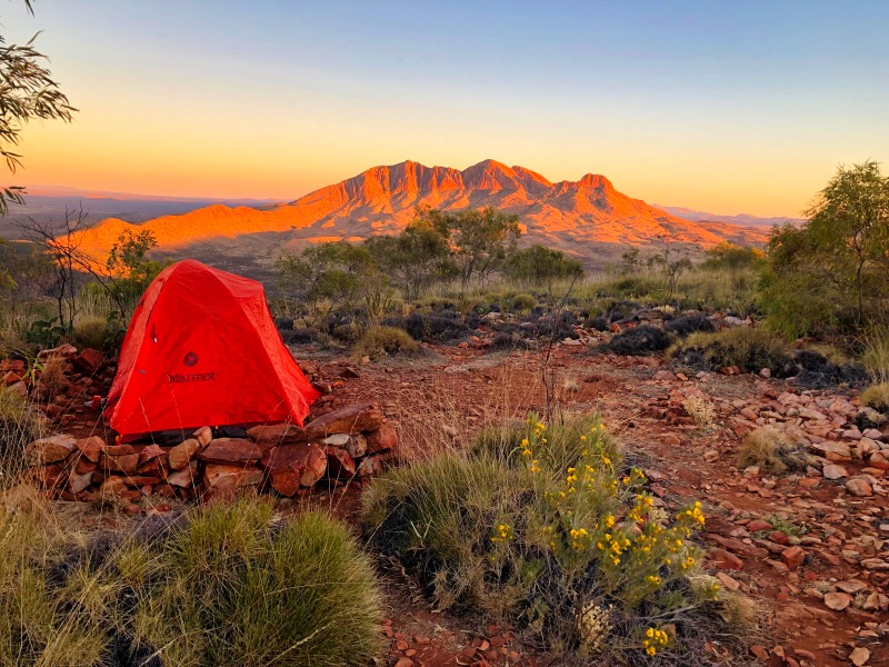
We love the Larapinta Trail! In our humble opinion, it’s the best hike in Australia.
Whether you walk it end-to-end or just tick off a few sections, time spent on the Larapinta is always time well spent.
To help you get the most out of this incredible trail, we’ve compiled a comprehensive guide to all of the 12 Larapinta trail sections, including details such as our top tips on the best campsites, swimming spots and more!
Australia Travel Resources
- Getting there: search for flights to Australia
- Guidebook: pick up a Lonely Planet Australia guidebook
- Where to stay: search for hostels and hotels
- Getting around: search for buses
- Rent a car: search for deals on car rentals
- Travel insurance: get travel insurance for your trip
- Money: get a Wise travel card to save big-time
Larapinta Trail Sections breakdown
Section 1: Alice Springs Telegraph Station to Simpsons Gap
- Distance: 24.7 km
- Time: 7 – 9 hours
- Difficulty: Moderate
- Camping: Wallaby Gap and Simpsons Gap
Section 1 of the Larapinta Trail isn’t overly challenging, but it does cover a long distance with some steep ascents.
The steepest climb is up Euro Ridge, which has great views of the area and even includes Alice Springs.
Some people complete this section in a whole day, but most camp midway at Wallaby Gap, which you’ll arrive at just after Euro Ridge.
Be sure to check out our definitive guide to the Larapinta Trail for further information on how to prepare for and tackle this epic trek!
Continuing on, the next big climb is up Hat Hill Saddle. Just after the Saddle, you’ll descend to Simpsons Gap, a popular spot for day-trippers.
For cultural reasons, you are not allowed to swim in Simpsons Gap.
Section 2: Simpsons Gap to Jay Creek
- Distance: 26.2 km
- Time: 7 – 9 hours
- Difficulty: Easy, but long
- Camping: Mulga Camp and Jay Creek
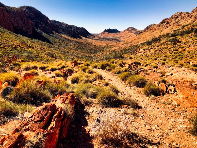
This is the most boring of all the Larapinta Trail sections. It is not particularly challenging, just long.
Check out the Jatbula Trail for another epic NT hike!
Because it is quite flat, you can do it in a day, so long as you are okay with the high km.
Otherwise, you can camp at Mulga Camp to break it up. I’ve camped here twice and enjoyed it. Most walkers overlook it, so it’s peaceful and quiet.
Section 3: Jay Creek to Standley Chasm
- Distance: 13.6 km
- Time: 5 – 6 hours
- Difficulty: Difficult
- Camping: Millers Flat and Standley Chasm
This is one of the most challenging Larapinta Trail sections.
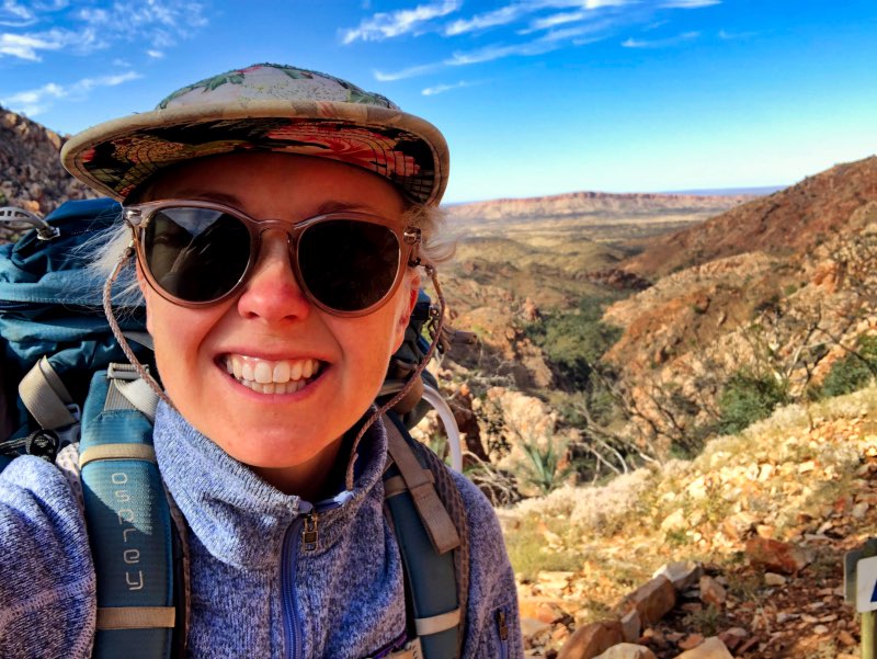
Leaving Jay Creek can be quite confusing as you’re walking along a sandy riverbed and there aren’t a lot of trail markers. This is a good spot to navigate on your phone.
There are two route options for Larapinta Trail section 3: the low route and the high route. I’ve done both!
The low route, while still difficult, is much easier than the high route. The high route is incredibly challenging, traversing some of the steepest inclines on the trail. The descent from the high route is like scrambling down a mountain face.
Did you know we offer Larapinta Trail Consultations?
Planning the Larapinta Trail is a lot of work! We can help alleviate some of the stress with our one-on-one consultations and planning support.
We offer customised meal planning services, customised itinerary planning services or whole package support for a complete E2E hike.
Prices start at $45/hour.
Get in touch via our contact page to let us know what type of support you’re looking for and we’ll get back to you with options and detailed pricing.
Since we’re talking about scrambling down a mountain face, this is probably a good time to remind you about travel insurance – get it. Shit happens here, and you want to be protected. We always use SafetyWing and love them!
Camping at Standley Chasm is a luxury, with hot showers, a good cafe and even laundry facilities! if you’ve spent many days on the trail, getting to clean your clothes is amazing.
Section 4: Standley Chasm to Birthday Waterhole
- Distance: 17.9 km
- Time: 8 – 10 hours. Most people camp overnight at Brinkley Bluff.
- Difficulty: Difficult
- Camping: Brinkley Bluff and Section 4/5 junction
Section 4 is yet another challenging Larapinta Trail section!
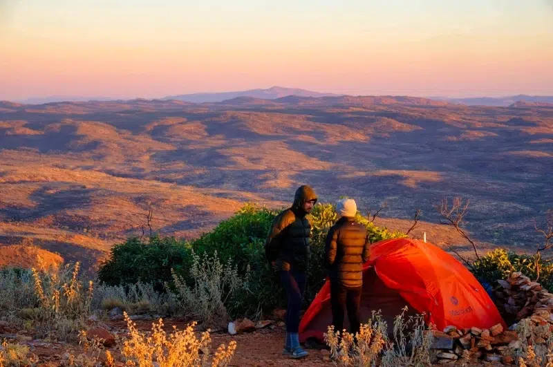
This section follows the Chewings Range to the summit of Brinkley Bluff, a great place to camp when wind conditions are minimal.
If the wind is blowing, consider camping elsewhere. Many a tent have perished here in high winds.
Wondering what to pack for the Larapinta Trail? Check out our Our Ultimate Mountain Hiking Packing List!
Section 5: Birthday Waterhole to Hugh Gorge
- Distance: 14.9 km
- Time: 7 – 9 hours
- Difficulty: Difficult
- Camping: Fringe Lily Creek and Hugh Gorge
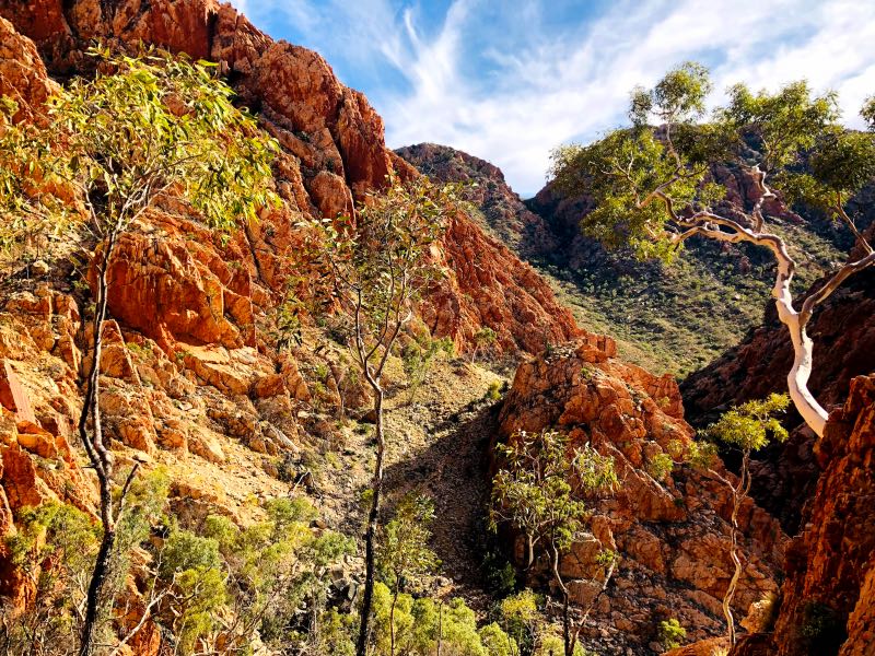
This is one of my favourite Larapinta Trail sections!
Section 5 goes along Razorback Ridge, one of my favourite parts of the entire Larapinta Trail.
You can walk off the track and further into Hugh Gorge to find some great swimming spots – highly recommended!
If you are going to do some exploring, please be safe. Always hike with a personal locator beacon. If you don’t want to fork out the cash for one, you can rent one from Larapinta Trail Trek Support.
Fringe Lily Creek is a nice spot to camp, BUT it can get surprisingly busy and water availability is touch and go.
You’ll definitely want a good water purification device for the water here! Every time I’ve hiked the Larapinta Trail I used my Steripen – it’s a godsend!
Section 6: Hugh Gorge to Ellery Creek South
- Distance: 28.9 km
- Time: 8 – 11 hours. You will need to camp overnight
- Difficulty: Moderate
- Camping: Ghost Gum Flat, Rocky Gully, Ellery Creek North and Ellery Creek Big Hole
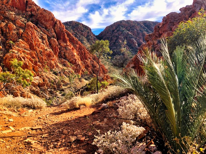
This is one of the longest Larapinta Trail sections and, as a result, almost everyone breaks it up into 2 days.
If you’re planning a rest day, Ellery Creek South is a great spot for it, with a big, inviting waterhole and a food drop waiting for you!
You can hike via Ellery Creek North, but you don’t get access to the waterhole, or the convenient Ellery Creek South food drop, so we don’t recommend this option for end-to-end hikers.
If you’re just heading out for a few days, however, it’s a different story!
Section 7: Ellery Creek South to Serpentine Gorge
- Distance: 12.8 km
- Recommended time: 4 – 6 hours
- Difficulty: Moderate
- Camping: Serpentine Gorge
The terrain on this Larapinta Trail section is gently undulating and avoids the big ascents/descents on other Larapinta Trail sections.
Trust us, it’s a nice change from earlier trails on the trail!
Section 8: Serpentine Gorge to Serpentine Chalet Dam
- Distance: 13 km
- Time: 4.5 – 6 hours
- Difficulty: Moderate
- Camping: Counts Point and Serpentine Chalet Dam
This is another one of my favourite Larapinta Trail sections.
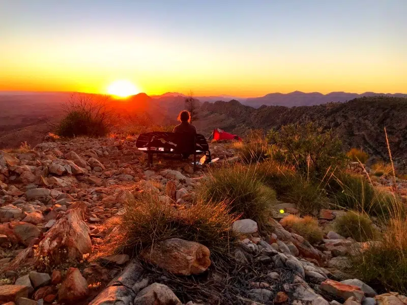
The views from Counts Point are incredible and in my opinion, the best on the whole Larapinta walk. You have stunning views of Haasts Bluff and Mt Zeil (the highest point in the NT).
If the wind is in your favour, do make a stop to camp at Counts Point. The sunset from the top is incredible.
If the wind is blowing, camp elsewhere. (I’ve camped here a few times and I was almost blown off the mountain on one of the nights. Seriously.)
Section 9: Serpentine Chalet Dam to Ormiston Gorge
- Distance: 28.3 km
- Time: 10 – 12 hours. You will need to camp overnight. Hermit’s Hideaway is a fantastic spot to camp for the night.
- Difficult: Difficult
- Camping: Waterfall Gorge, Mt Giles Lookout, Hermit’s Hideaway and Ormiston Gorge
This is a hard Larapinta Trail section. Yes, another one.
While this section is steep, what really makes it difficult is the lack of shade and water.
There are long sections that are completely exposed (so time your departure so that you’re not walking through the valley in the middle of the day) and there are no water tanks except for at either trailhead.
There is no reliable surface water along the way, so if you decide to walk this section you will have to carry a heavy pack with a two-day supply of drinking water.
We recommend carrying at least 6-7L of water per person for this Larapinta Trail section if you will be camping overnight at Hermit’s Hideaway (recommended).
We recommend a good-quality water bladder (or two). We use the MSR DromLite and it’s amazing – 5 years and counting and ours are still going very strong!
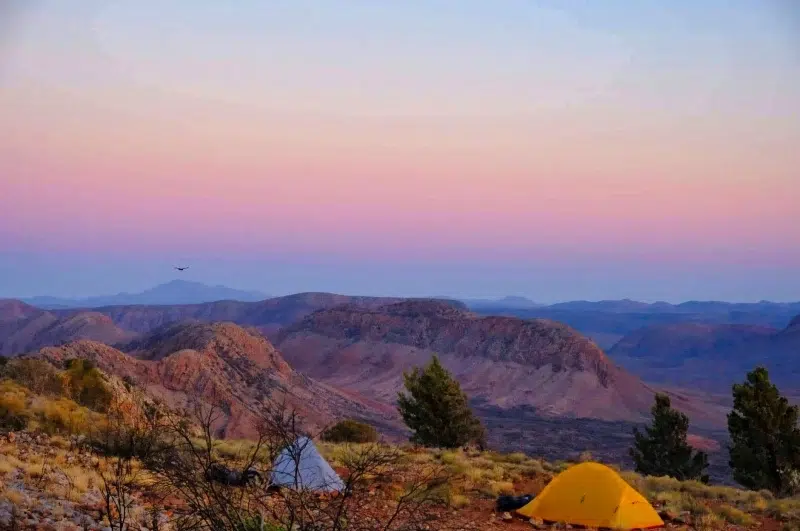
If you want to camp on the ridge, you can choose between Mt Giles Lookout and Hermit’s Hideaway. I’ve camped at both and prefer Hermit’s Hideaway, as it has more shelter from the wind (and privacy).
When you get to Ormiston Gorge, you can have a shower!
Section 10: Ormiston Gorge to Finke River
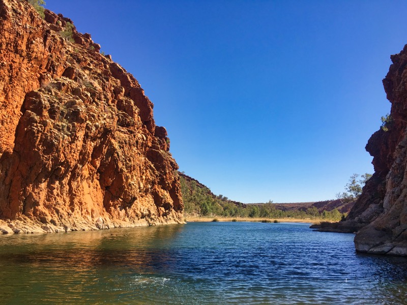
- Distance: 9.1 km
- Time: 3 – 4 hours
- Difficulty: Easy
- Camping: Finke River
This is the shortest and easiest of all the Larapinta Trail sections. It’s like walking through a pleasant meadow.
If there’s been a lot of rain the previous summer, then the valley is filled with wildflowers.
Section 11: Finke River to Redbank Gorge
- Distance: 26.3 km
- Time: 9.5 hours. You will need to camp overnight. Hilltop Camp is a fantastic place to camp with the best view of Mt Sonder on the Larapinta Trail.
- Difficulty: Moderate
- Camping: Hilltop Lookout, Rocky Bar Gap and Redbank Gorge
This is a lovely Larapinta Trail section as you near the end of the trail.
Hilltop Lookout provides the best view of Mt Sonder on the entire trail.
Sunrise is particularly amazing, and it’s worth a camp just to catch it (see our featured photo at the top of the article).
Section 12: Redbank Gorge to Mt Sonder return
- Distance: 15 km
- Time: 6 hours
- Difficulty: Moderate
- Camping: Redbank Gorge
I’ve climbed Mt Sonder at least 4 times (I’ve lost track) and it’s always impressive. This is a great finale to your Larapinta walk.
Leave your pack at Redbank Gorge and enjoy the pack-free hike up Mt Sonder!
And Don’t Forget – our Larapinta Trail Consultations Are Here to Help!
We can help with a wide range of Larapinta Trail planning services, so your focus is on enjoying the trail.
Prices start at $45/hour.
Get in touch via our contact page to let us know what type of support you’re looking for and we’ll get back to you with options and detailed pricing.
Disclaimer: This post may contain affiliate links. If you buy or book anything through them, we’ll earn a small commission at no extra cost to you. Thank you for supporting this website!
